27. August 2025
Mapbender-Version 4.2.0 released
New data source Vector Tiles and many improvements await you in the new feature release. Read the visual changelog.
Click here for the German version: Switch to German
On August 27, 2025, the Mapbender team released the new Mapbender version 4.2.0. Many thanks to everyone involved.
The new version is a feature release with numerous innovations, a revision of the architecture for integrating data sources, support for Vector Tiles as a data source, and several features and bug fixes.
Updating existing Mapbender installations to version 4.2.0 is easy. Please note the update instructions in the document upgrading.
This article highlights a few of the new features. The complete list of all new features can be found in the changelog.
Architectural changes in the area of data sources
The handling of data sources has been revised to simplify the addition of new data source formats in the future [#PR1745]. The first new format to be added was support for vector tiles (with Mapbox Style JSONs) as a new data source. More new formats will follow.
New data source: Vector Tiles
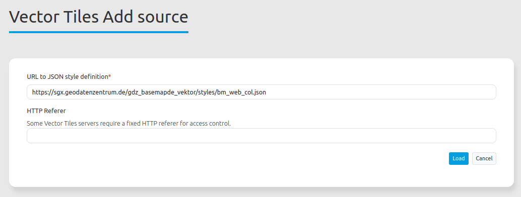
Vector Tiles are an efficient format for visualizing geodata. Instead of downloading rendered images for each section and zoom level, vector data is rendered on the client. Starting with version 4.2, Mapbender supports Vector Tiles via the Mapbox Style JSON format as a new data source [#PR1748], [#PR1753].
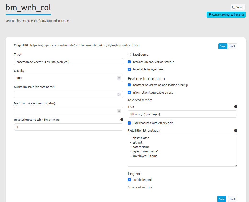
The configuration in Mapbender is similar to that for WMS. You must load a data source in Mapbender and specify the address for a configuration. The linked JSON file contains information about the data itself (the Vector Tiles) as well as information about how it is displayed.
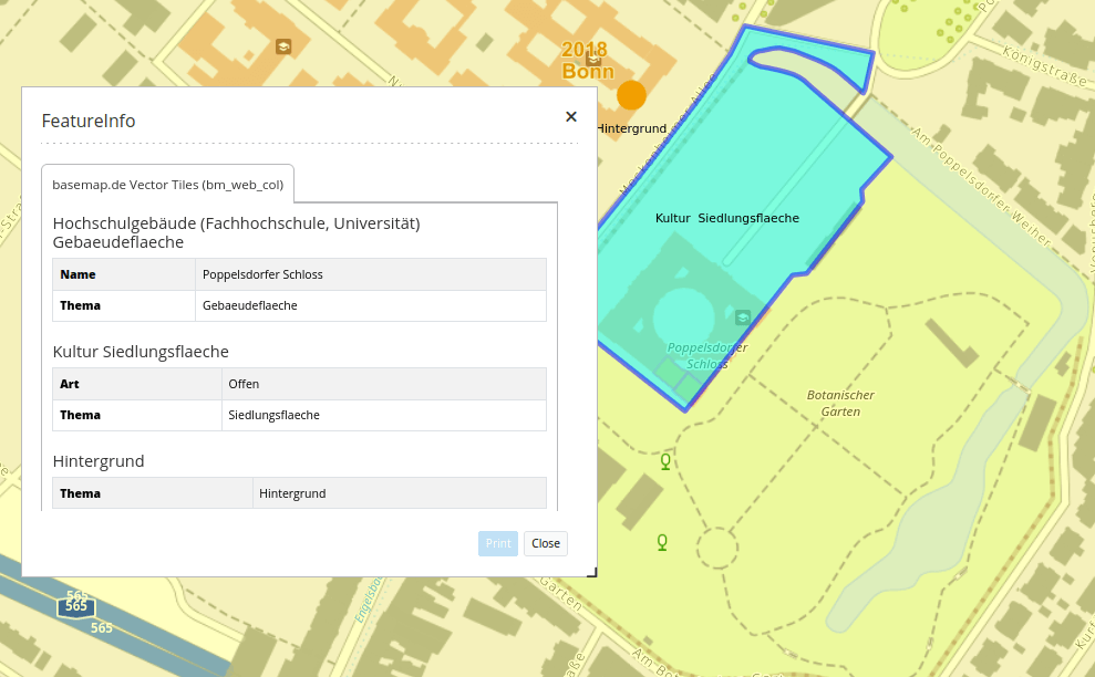
The service can then be inserted into an application and configured per instance. For example, the transparency can be adjusted. The output of information can be customized, as can the output in the legend. For further customization options, please refer to the documentation.
The documentation has been adapted for the new data source. The following links provide everything you need to know about integration and configuration:
- https://docs.mapbender.org/de/backend/sources.html#vector-tiles
- https://doc.mapbender.org/en/backend/applications/layerset.html#layerset-instances
If you would like to test the new format, we recommend the following services:
- basemap.de Web Vector: Color: The colored standard map without terrain display (see basemap.de/): https://sgx.geodatenzentrum.de/gdz_basemapde_vektor/styles/bm_web_col.json
- OpenStreetMap Vector Tile Service (bright style, hosted by the WhereGroup): https://wms.wheregroup.com/tileserver/style/osm-bright.json
Layer Tree – Filtering themes
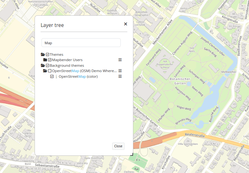
For the layer tree, the functionality for filtering themes, groups, and layers can be optionally activated via a checkbox [#PR1749]. A text field for filtering appears above the layer tree. When searching for a term, only topics containing the search term are displayed. The term is highlighted in color. https://doc.mapbender.org/de/elements/basic/layertree.html
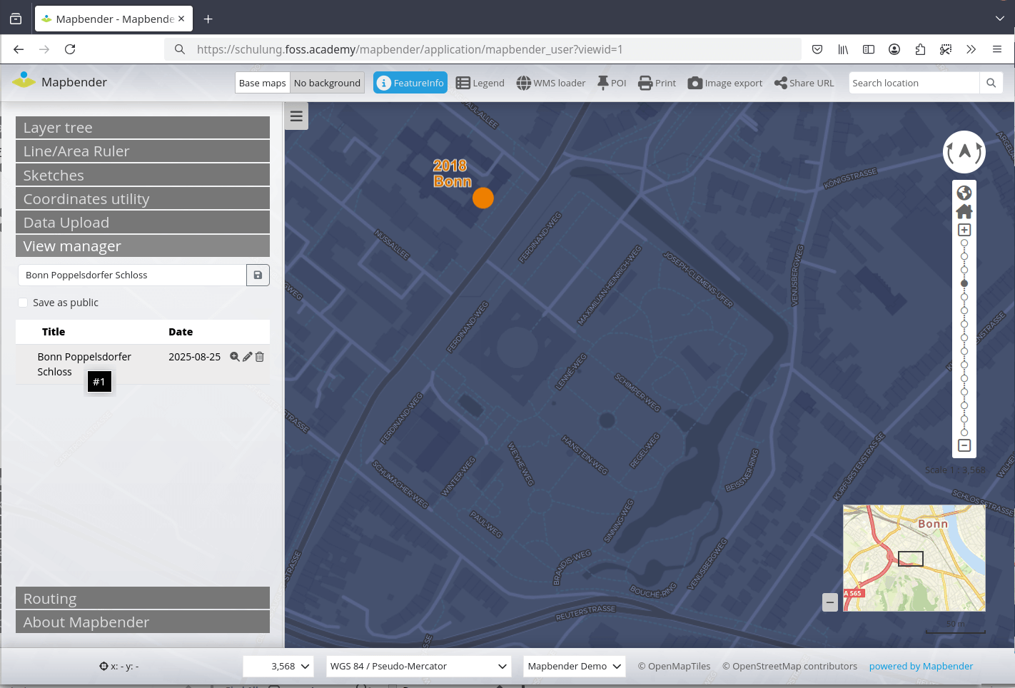
Revision of view management
ViewManage allows you to save the map section, the configuration of the layer tree, and added services under a freely assignable name and call them up again at a later time.
This functionality has been revised. In addition to the complete settings in the tree, information about self-loaded services is now also saved.
Another new feature is the ability to call up a saved configuration using the ID: The viewid call parameter can be used to load a specific configuration directly when the application is launched.
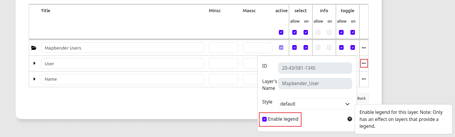
Legend can be disabled per layer
Sometimes, the legend for individual layers should not be displayed. This can now be customized. The legend can now be disabled for each layer in the WMS instance configuration area [#PR1758].
For more information, see the documentation.
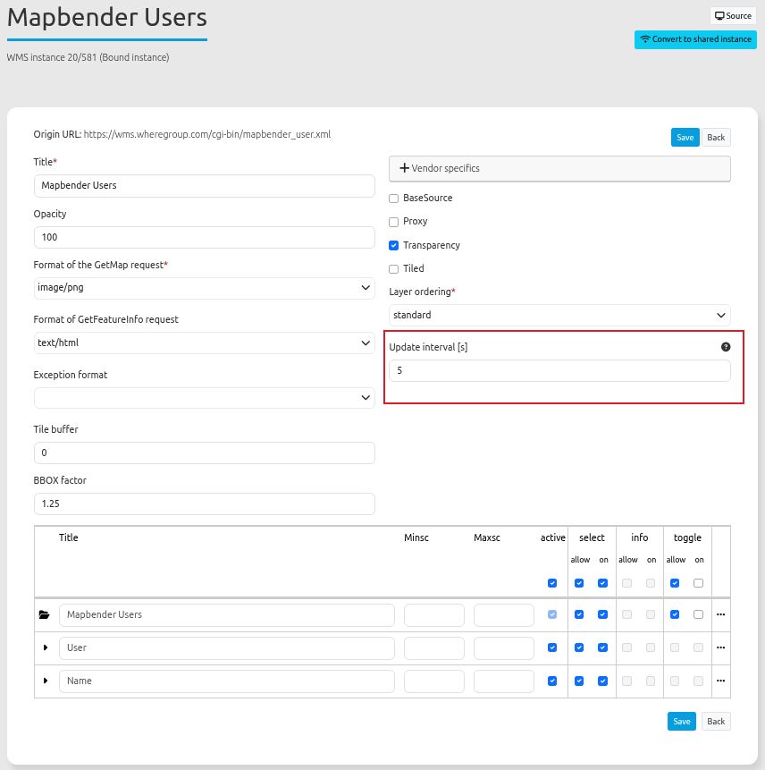
WMS Auto-Refresh of the Map
An additional parameter, refreshInterval, can be specified in the WMS configuration [#PR1759].
If this parameter is set, the service is automatically refreshed after the specified number of seconds. This can be used, for example, for WMS services that are intended to visualize sensor data, where the status is constantly changing and therefore the map must be updated.
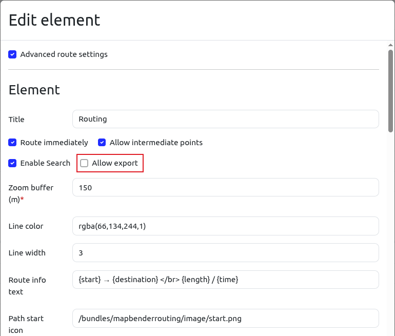
Routing - Exporting the calculated route
The calculated route can now be exported to GeoJSON, GPX, and KML and is available for download. This function can be activated optionally [#PR1764].
Accessibility
Several adjustments have been made in the area of accessibility. All buttons, controls, and elements can now be accessed using the tab key and activated using the enter key [PR#1742], [PR#1751].
IDs are no longer used in HTML for Mapbender elements. Each embedded element is given a unique identifier [#PR1750].
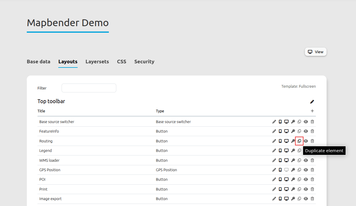
Backend cloning of elements
Elements can be copied using a new button on the element [#PR1705]. This significantly reduces the configuration effort.
Backend administration in a uniform design
The backend now has uniform icons, and their order during configuration has been standardized across the backend.
Performance improvement
Applications with many layers took longer to load. The loading behavior has been revised, improving loading times [#PR1744], [#PR1756].
Other minor changes and bug fixes
In addition, the changelog provides a complete overview of the changes
Update to the new version
We recommend that you update to Mapbender 4.2.0 and hope you enjoy the new version.
Please refer to the migration guide in the documentation. It contains additional information about updating to new versions.
All other important information, as well as links to downloads and documentation, can be found on the Mapbender website.
Mapbender has Docker integration and an official Docker repository on DockerHub.
Would you like to try Mapbender?
You can find a demo of the current version at https://mapbender.org/demo/. If you would like to get an insight into the Mapbender backend, you will need to install Mapbender.
QGIS2Mapbender QGIS plugin
At this point, we would also like to mention the QGIS2Mapbender plugin.
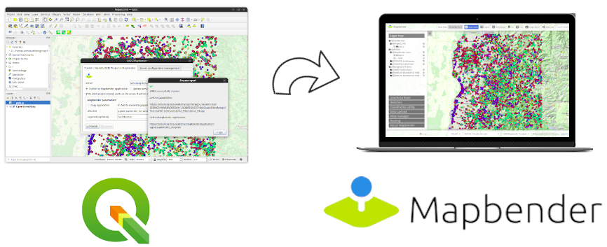
With this plugin for QGIS, it is possible to publish QGIS desktop projects as OGC WMS in just a few steps and simultaneously load the WMS into a Mapbender application. The plugin is available in version 1.0.0 and uses the Mapbender API.
A detailed blog article by Jörg Thomsen about the QGIS2Mapbender QGIS plugin can be found on the WhereGroup blog.
What's next?
With the major version 4.2, the Mapbender team has once again taken a big step forward. Bugfix releases will be published in the coming months if any errors occur.
The Mapbender PSC will meet in the coming weeks to define the next milestones. We will, of course, keep you up to date.
Until then, we hope you enjoy the new version 4.2.0!
Important links
- Mapbender website: https://mapbender.org/
- Mapbender download packages: https://mapbender.org/builds
- Mapbender Tag version 4.2.0: https://github.com/mapbender/mapbender-starter/releases/tag/v4.2.0
- Update to 4.2.0: https://github.com/mapbender/mapbender/blob/master/UPGRADING.md
- Changelog: https://github.com/mapbender/mapbender-starter/blob/master/CHANGELOG.md
- Documentation: https://doc.mapbender.org/
- Mapbender Docker: https://hub.docker.com/r/mapbender/mapbender
- Mailing list: https://lists.osgeo.org/mailman/listinfo/mapbender_users
- Bug Tickets: https://github.com/mapbender/mapbender/issues