11. Februar 2025
Mapbender-Version 4.1.0 released
New routing and API features and many small improvements await you in the new feature release. Read the visual changelog.
Click here for the German version: Switch to German
On February 12, 2025, the Mapbender team released the new Mapbender version 4.1.0. Many thanks to everyone involved.
The new version is a feature release with numerous new features, a redesign and bug fixes.
Existing Mapbender installations can be updated to version 4.1.0 without any problems. Please follow the instructions for updating in the document github.com/mapbender/mapbender/blob/master/UPGRADING.md
In this article, only the most important new features are highlighted due to the quantity. The complete list with all new features can be found at github.com/mapbender/mapbender-starter/blob/master/CHANGELOG.md
New Routing Element
A new routing element (PR#1655) has been developed that enables routing via the Open Source Routing Machine (OSRM). You can either click on the map to define the start and destination, or you can search for addresses using a search service such as Solr. Intermediate destinations can be defined and the route can be reversed.
You can search for a route for different vehicles such as cars or bicycles and also for pedestrians. The route is displayed on the map. The routing provides information about the length of the route and the time. The routing instructions are also displayed in a table.
Visit the documentation of the Routing element: https://doc.mapbender.org/en/elements/search/routing.html
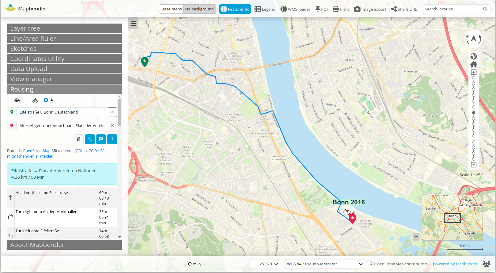
In the backend, you can configure the search and routing service, change the color for the route display and also configure the text for the result display.
The new routing element offers many ideas for future developments, such as support for other routing services, printing the route or downloading the route in various formats such as GPX.
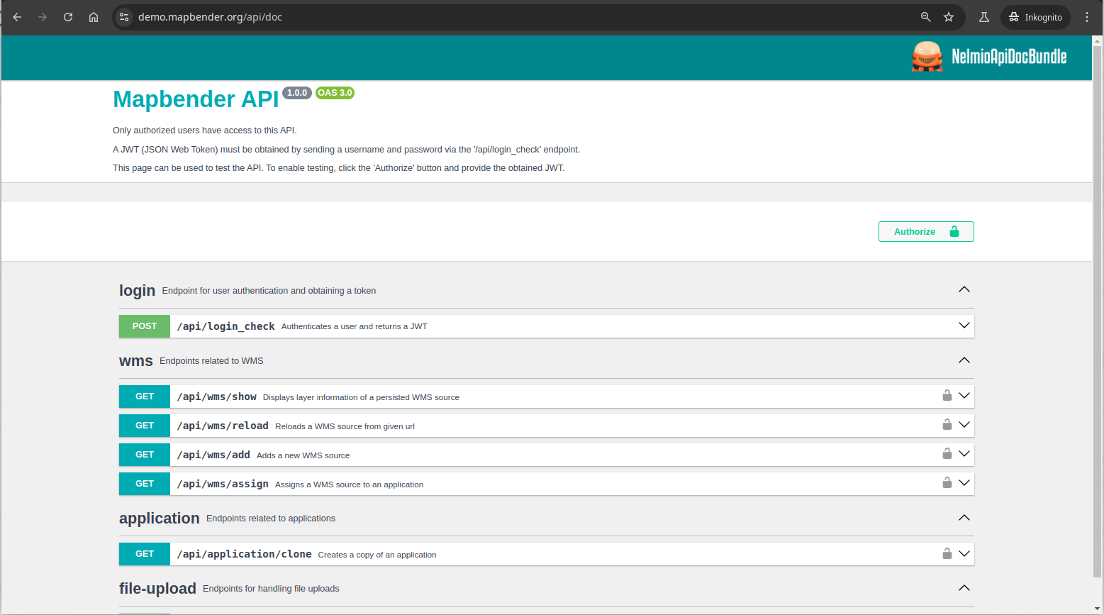
API
With version 4.1.0, we are introducing the Mapbender API. This means that operations that could previously only be used via the browser-based administration or on the console via bin/console commands can now also be executed via the API.
A global authorization controls which users are allowed to use the API.
This new API will soon be used in the QGIS2Mapbender plugin.
Visit API-Dokumentation: https://doc.mapbender.org/en/customization/api.html
New features in the Layertree
The team has extended the Layertree element and improved the user-friendliness.
If layers of a WMS provide several styles, it is now possible to select them in the context menu of the Layertree (PR#1636, PR#1648, PR#1674). To be able to offer this function, you must activate “Select style” in the backend in the layer tree element under Menu.
doc.mapbender.org/en/elements/basic/layertree.html
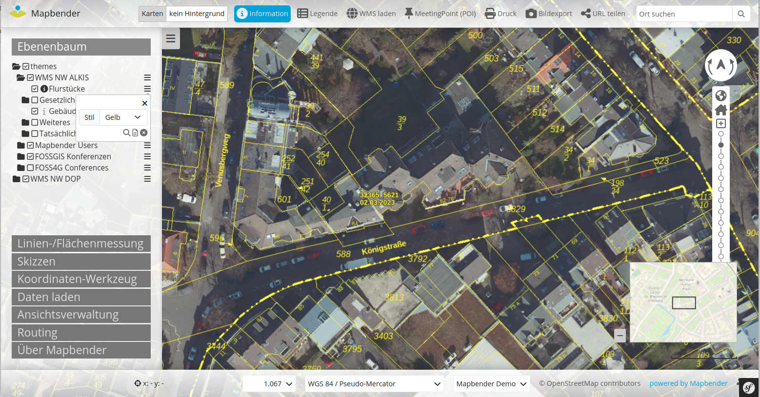
A new feature is the activation/deactivation of a layer by clicking on the layer name (PR#1641).
It is now also possible to change the status of all sublayers by holding the Shift key while switching a layer (PR#1664).
Load WMS via a link - new option mb-infoformat
There is a hidden feature in the WMSLoader element that allows you to define a link with an mb-action that can be used to add a WMS. The new option mb-infoformat can now be used to define which FeatureInfo format should be used for the WMS (PR#1653).
The following example shows a link that can be used to add a WMS. Here, text/plain is set as the FeatureInfo format.
<a href="#“
mb-action="source.add.wms“
mb-layer-merge="1“
mb-wms-merge="1“
mb-wms-layers="_all“
mb-url="https://wms.wheregroup.com/cgi-bin/mapbender_user.xml?VERSION=1.3.0&REQUEST=GetCapabilities&SERVICE=WMS“
mb-infoformat="text/plain“
>Demo-WMS laden</a>
Further information can be found in the documentation doc.mapbender.org/en/elements/misc/wms_loader.html
Support of labels in FeatureInfo highlighting
Mapbender offers the highlighting of hits in FeatureInfo. See
doc.mapbender.org/en/elements/basic/feature_info.html
Now it is possible to add a data-label parameter in the definition if you want to specify a label for the selected object (PR#1670).
ApplicationSwitcher
You can provide a select box in your applications with which you can switch to other applications. The applications are selected in the backend. It is now possible to re-sort applications in the backend using drag & drop. (PR#1666)
Poi marker can now be minimized and removed
The Meeting Point (POI) element makes it possible to display a marker with text on the map. Added the option to minimize and completely remove the marker and text (#1273, PR#1673)
Usability improvements for the backend
There are some improvements for easier administration in the backend. We hope you will like them.
Sorting functions for users, user groups and global authorizations have been added (PR#1633).
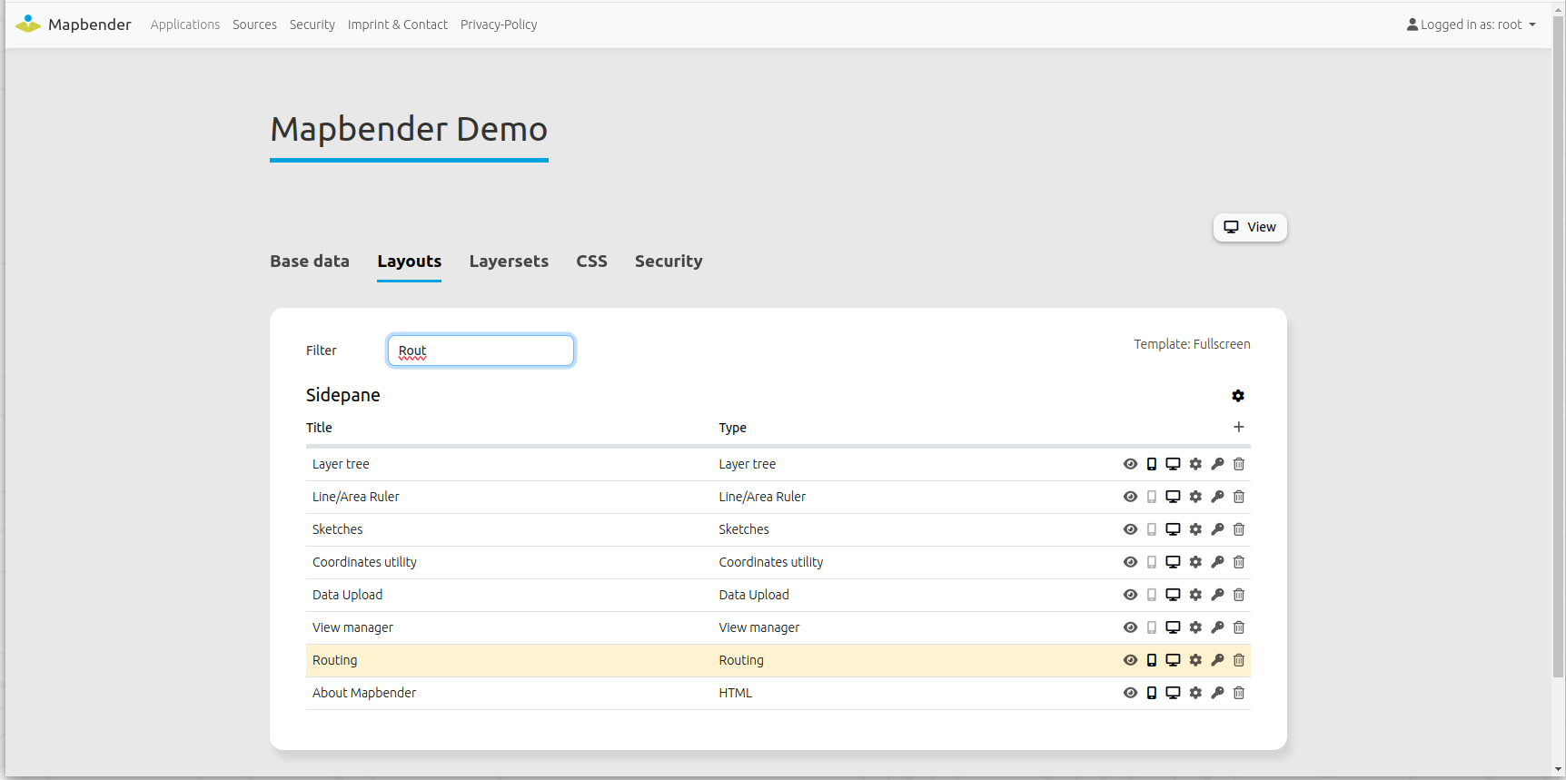
Filtering for layouts has been added.
Filtering has also been improved. Now the hits of the filtering are highlighted (PR#1632).
Figure : Mapbender backend - highlighting when filtering
New features in the testing area
There is a new repository mapbender-tests, which contains end-to-end (E2E) tests written in Cypress.
Documentation on its use can be found in the README file at github.com/mapbender/mapbender-tests
New features in the testing area
New features in the testing area
There is a new repository mapbender-tests, which contains end-to-end (E2E) tests written in Cypress.
Documentation on its use can be found in the README file at github.com/mapbender/mapbender-tests
Further minor innovations and bug fixes
The changelog also provides a complete overview of the changes
github.com/mapbender/mapbender-starter/blob/master/CHANGELOG.md
Upgrade to the new version
We recommend that you update to Mapbender 4.1.0 and hope you enjoy using the new version.
Please refer to the migration guide in the documentation. It contains additional information on updating to new versions.
doc.mapbender.org/en/installation/migration.html
All other important information as well as links to the download and documentation can be found on the Mapbender website mapbender.org
Mapbender has a Docker integration and an official Docker repository on DockerHub hub.docker.com/r/mapbender/mapbender.
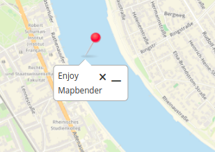
Would you like to try out Mapbender?
You can find a demo of the current version at mapbender.org/demo/. If you want to get an insight into the Mapbender backend, you need to install Mapbender.
What's coming next?
With the major version 4.1, the Mapbender team has taken another big step forward. Over the next few months, bugfix releases will be released if any errors occur.
In the next few weeks, the Mapbender PSC will meet to define the next milestones. We will of course keep you up to date.
Until then, we hope you enjoy the new version 4.1.0!
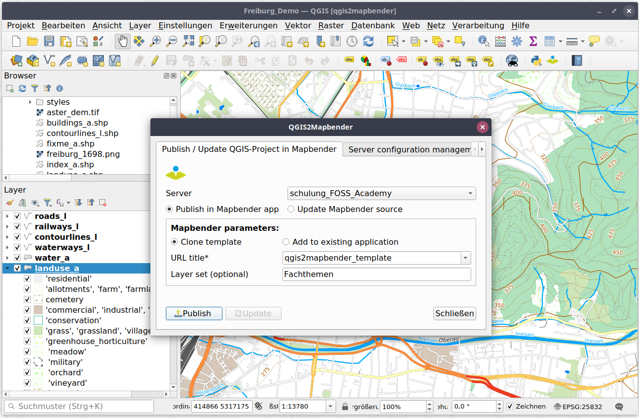
QGIS2Mapbender QGIS-Plugin
The Mapbender QGIS plugin QGIS2Mapbender will be converted to the new Mapbender API in the next few weeks. You can find the current status at github.com/WhereGroup/QGIS2Mapbender
With the new plugin for QGIS it is possible to publish QGIS desktop projects as OGC WMS in just a few steps and at the same time load the WMS into a Mapbender application.
A detailed blog article by Jörg Thomsen about the QGIS2Mapbender QGIS plugin can be found in the WhereGroup blog at wheregroup.com/mapbender-anwendungen-einfach-direkt-aus-qgis-heraus-erstellen
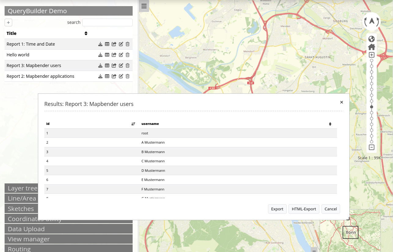
Do you already know the QueryBuilder?
The QueryBuilder is not included in the standard scope of Mapbender, but can be added. The QueryBuilder provides an element that can be used to display evaluations from the database. You can define SQL queries and give them a title. These are displayed in the applications as tables or in an HTML view and can be downloaded as an Excel list.
Information on the setup can be found in the README file at github.com/mapbender/query-builder
Important links
Mapbender Website mapbender.org
Mapbender download packages mapbender.org/builds
Mapbender Tag Version 4.1.0 github.com/mapbender/mapbender-starter/releases/tag/v4.1.0
Upgrading information github.com/mapbender/mapbender/blob/master/UPGRADING.md
Changelog github.com/mapbender/mapbender-starter/blob/master/CHANGELOG.md
Documentation doc.mapbender.org
Mapbender Docker hub.docker.com/r/mapbender/mapbender
Mailing list lists.osgeo.org/mailman/listinfo/mapbender_users
Bug Tickets github.com/mapbender/mapbender/issues