26. Juni 2024
Mapbender-Version 4.0.0 released
All details about the new major release - Visual Changelog
Click here for the German version: Switch to German
On the 26th of June 2024, the Mapbender team released the new Mapbender version 4.0.0. Many thanks to all involved.
The new version is a major release with numerous new features, a redesign and bug fixes. Existing Mapbender installations can be updated to version 4.0.0 without any problems. Please follow the instructions for updating in the document. Update Instructions.
Due to the large number of updates, only the most important new features are highlighted in this article. The complete list with all new features can be found at GitHub.
Breaking Changes
PHP versions 8.2 and 8.3 are fully supported. PHP 8.1 is now the minimum supported PHP version.
Support for OpenLayers 2 has been removed. All applications automatically use the current OpenLayers version 9 (PR#1483).
The directory structure has changed. The changes are explained in the document.
Numerous software components have been updated. This affects Symfony and other libraries such as Bootstrap, Twig and FontAwesome. Read more about this in the Mapbender Core Changelog.
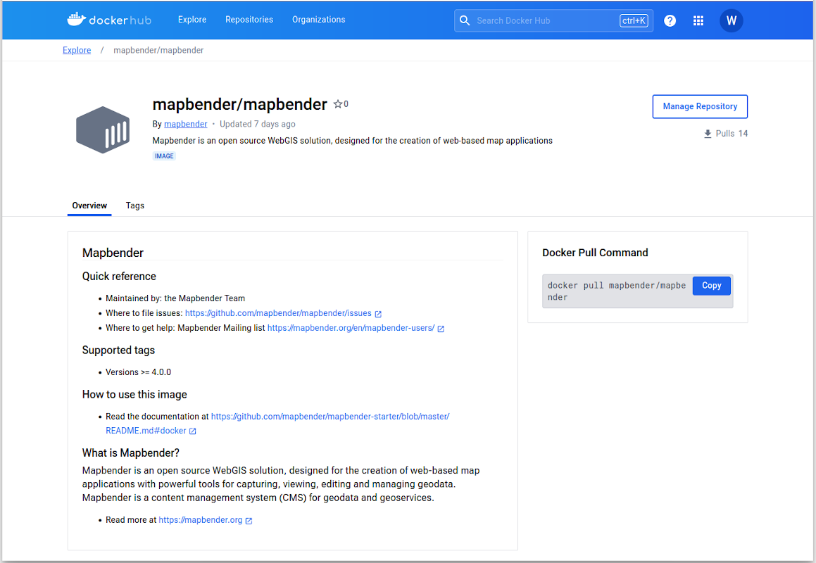
Docker integration and official Mapbender Docker image
Mapbender now has a Docker integration and an official Docker repository on Docker Hub. Many thanks to Max Tobias Weber from WhereGroup for the implementation. The documentation on the use of Mapbender Docker containers can be found here. Some more information about the background of the implementation. When a Mapbender version is released, the integration now automatically builds an image and creates a tag on Docker Hub. The concept for building images can also be used in your own Mapbender projects. Further information on the implementation can be found in PR#125.
Features & Improvements
The following section deals with the new features and improvements.
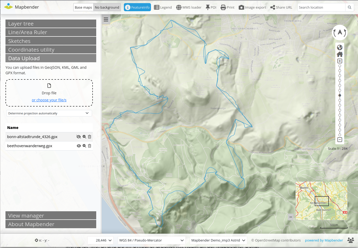
New Data Upload Element
Files can be temporarily loaded into an application using the Data upload element. GeoJSON, KML, GML and GPX are currently supported formats. When loading, the projection is determined from the data or can be specified. After loading, you can zoom in on the extent of the data, hide it again and also remove it from the application (PR#1560). The element can be expanded in future versions. Support for further formats is conceivable, as well as customisation of the style and output of information.
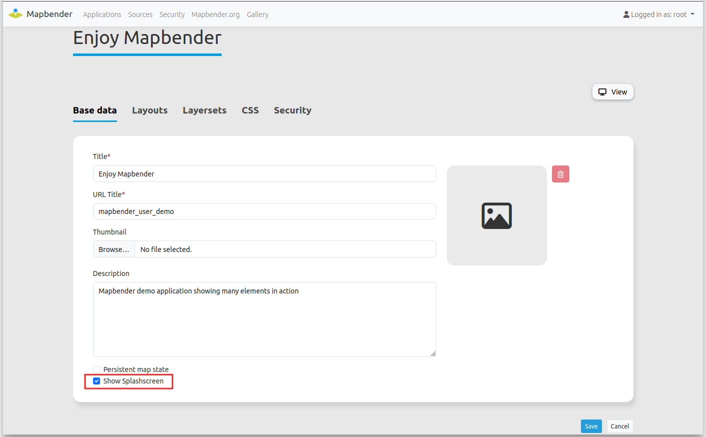
Splash screen for all applications
When starting an application, a splash screen (start loading image and text) can be displayed. The application name and an image are displayed. The image can be customised. The functionality can be activated or deactivated for each application via a checkbox in the application settings (Documentation).
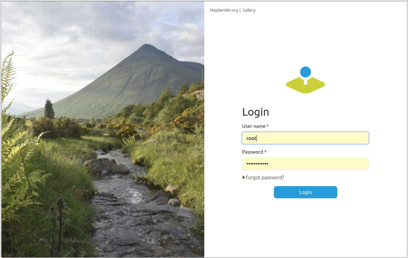
New login screen
The login image is changed with every major release (PR#1542). The picture shows Beinn Dorain in the Scottish Highlands. Many thanks to Thorsten Hack from WhereGroup for providing the image.
You can customise the login image via the configuration in parameters.yaml and link to your own image if you wish.
New Design for Mapbender
The design has been revised in both the frontend and the backend. The buttons used have been standardised and revised, i.e. elements such as digitizers and sketches now use the same buttons. The demo applications have been revised. They contain most of the available elements and are intended to illustrate the possibilities offered by Mapbender. A standardised button style using Bootstrap CSS classes is now used (PR#1558).
Take a look at the new version in the demo:
Translations
The applications and the administration backend have now been fully translated and are available in English, German, Italian, Russian, Spanish and Portuguese. The translations for Dutch, Ukrainian and French are not yet complete. We are still looking for support here. New languages are also very welcome. Please contact the Mapbender team via the mailing list.
Sidebar
The width of the sidebar can be configured using drag & drop. This functionality is activated by default, but can be deactivated per application (PR#1539).
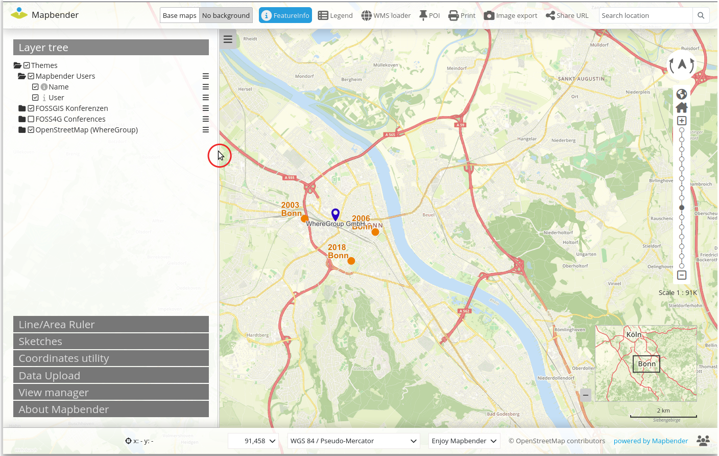
Layer tree
There are a few small but practical new features to mention in the layer tree. It is now possible to activate/deactivate the layer by clicking on the layer name. When you activate a layer, the superordinate layers are automatically activated so that the layer is displayed directly in the map (PR#1544). In addition, the sorting problem in the layer tree has been fixed (PR#1567).
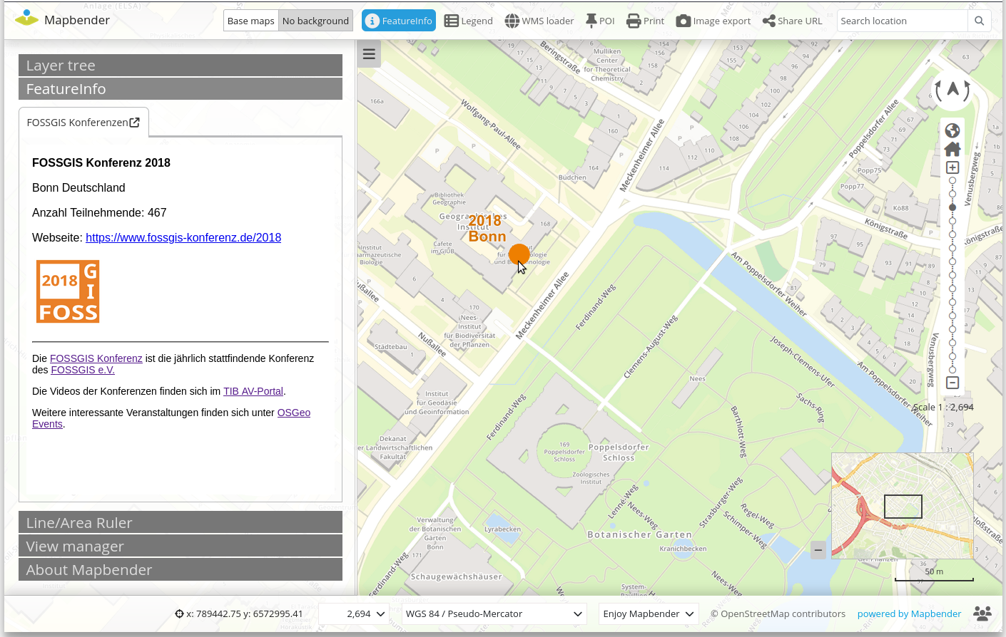
Information query via FeatureInfo
The tabs of the FeatureInfo output are now displayed in the order in which the topics are present in the layer tree (PR#1534). The FeatureInfo element can now also be used in the sidebar. As soon as the FeatureInfo tab is opened, the function is activated. The results are displayed accordingly in the sidebar.
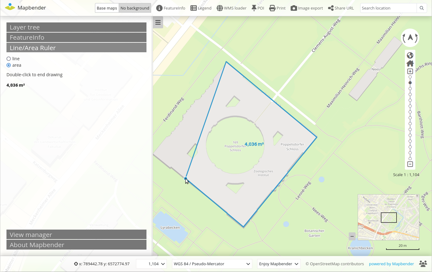
Measure via Ruler
The measuring tool (Ruler) can now also be used in the sidebar. As soon as the Measure tab is opened, Measure is activated. The results are displayed accordingly in the sidebar. Another new feature in the Measure element is the option to perform line/area measurements using a single integrated element. Previously, the element had to be included twice. Now the selection of whether a line or area measurement is to be made in the application is made via radio buttons (PR#1581).
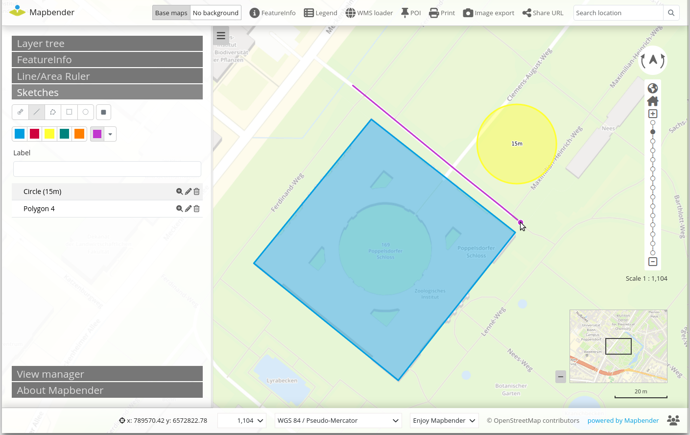
Sketch
The Sketch element enables the simple drawing of temporary objects. A new feature is that the objects are now also drawn in the colour that was previously selected (PR#1584).
Searching with the SearchRouter
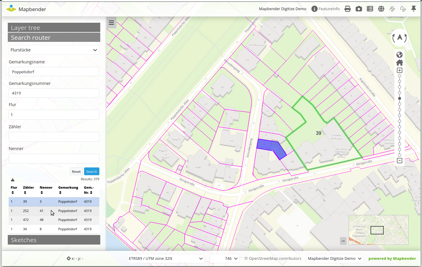
Searching with the SearchRouter has new options and functionality. The hit list also appears in our new design. Individual columns in the result table can be sorted by clicking on the header. The configuration can be used to define which column the results should be sorted by and whether this should be in ascending or descending order (sortBy, sortOrder). The new parameter exportcsv can be used to activate the option to export the results list to CSV. The new parameter zoomtoExtent has the effect of zooming directly to the area of the current results. The search results can now also be labelled in the map. This follows the same concept as the digitizer labeling. A detailed description of the new options can be found in the documentation.
The output of the map as a PDF has been improved. It is now possible to output a descriptive map legend on the map. Mapbender takes over the configuration according to the LibreOffice Draw template.
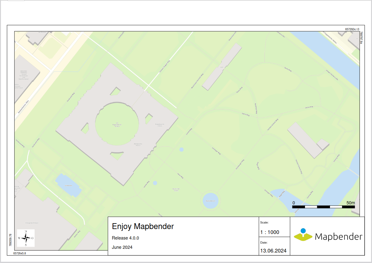
Another new feature is that the legend is now output on the second page in the orientation of the map, i.e. an A4 print in landscape format also outputs the legend in landscape format. When outputting dynamic texts, e.g. title or scale, Mapbender now also takes into account the orientation of the text (e.g. centred or right-aligned). You can find updated documentation on printing here.
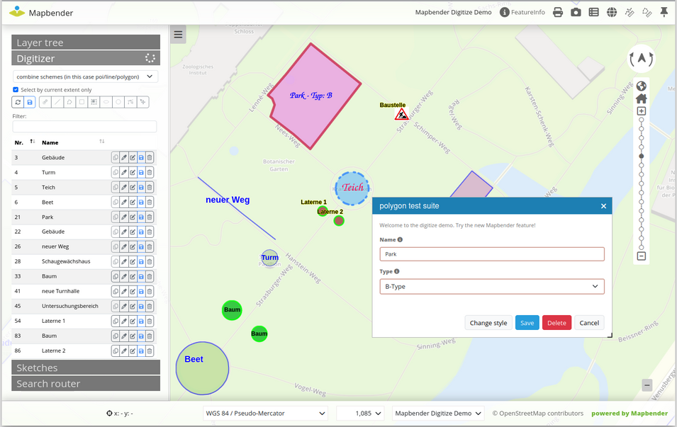
Data acquisition with the digitizer
With Mapbender version 4.0.0, there is also a version jump for the digitizer. Version 1.6 is now available, which includes many new features. You can find an overview in the CHANGELOG.md.
The documentation has also been updated so that the options are documented in detail here.
The following list shows a few new features:
- New design adapted to the new standard design
- Snapping of interpolation points
- Improved display of texts
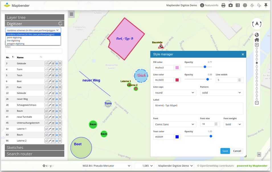
- Style customisation of objects is now also possible for points and lines
- Removing a vertex by clicking on an existing vertex
- Combination of scheme configurations
WMTS / TMS
The integration of WMTS and TMS as data sources has been improved. The data sources can now be used in the overview and in the base source switcher. They can also be deactivated at startup. Output in print is also possible.
Buttons
The button element now displays the icons graphically. A few new standard icons are available. Custom icons can be defined so that the selection in the button element is extended. The standard Mapbender icons can also be deactivated. Icons are configured in the parameters.yaml file.
mapbender.icons.disable_default: true
mapbender.icons.disable_default_fa: true
mapbender.icons.custom:
    - name: iconSnowflake
      title: Schneeflocke
      class: fa-solid fa-snowflake
    - name: iconHeartbeat
      title: Herzschlag
      class: fa-solid fa-heart-pulse
A detailed description can be found in the documentation
Activate themes when launching applications via visiblelayers
Application start via visiblelayers now also supports the layer name.
?visiblelayers=<RootLayerName>/<LayerName>The use of the name in the call is recommended, as the ID of the layer changes each time a WMS is updated. Learn more
New and extended console commands
The console commands can now be found in the bin directory (previously app). Two commands should be emphasised here.
- bin/console mapbender:wms:show
- bin/console mapbender:wms:assign
bin/console mapbender:wms:show
The command now outputs extended information. The output is now also possible in JSON.
- bin/console mapbender:wms:show – Lists all WMS with the source ID, the service address and the name and title of the layer.
- bin/console mapbender:wms:show 1 – If the source ID is passed in the call, the corresponding information on the specific service is displayed.
bin/console mapbender:wms:assign
The new command bin/console mapbender:wms:assign makes it possible to load a WMS registered in Mapbender into an application via the console. The layerset to which the WMS is to be added can be defined. Learn more
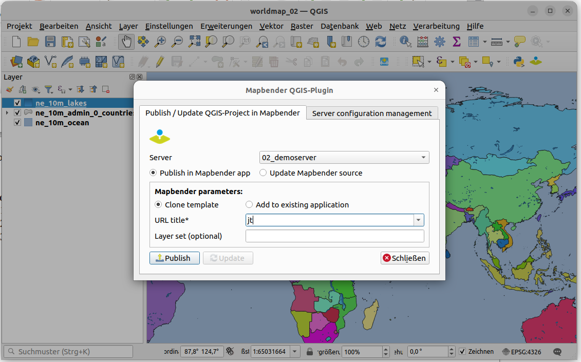
Mapbender QGIS Plugin
At this point we would like to draw your attention to the new Mapbender QGIS plugin that has just been released by WhereGroup. Many thanks to Carmen Viesca for the realisation. You can find it on GitHub. With the new plugin for QGIS it is possible to publish QGIS desktop projects as OGC WMS in just a few steps and at the same time load the WMS into a Mapbender application. It is possible to select the Mapbender application into which the service is to be loaded and also the layerset. It is also possible to update existing WMS via the plugin in Mapbender. This is necessary, for example, when new layers are added. The big advantage of the plugin is that many administration steps can be carried out directly in QGIS and it is not necessary to switch to Mapbender administration for some steps.
A detailed blog article by Jörg Thomsen about the Mapbender QGIS plugin can be found in the WhereGroup blog.
Further information in the changelog
The changelog also provides a complete overview of the changes.
Switching to the new version
We recommend that you update to Mapbender 4.0.0 and hope you enjoy the new version. Please refer to the migration guide in the documentation. It contains additional information on updating to new versions.
Would you like to try out Mapbender?
You can find a demo of the current version here. If you want to get an insight into the Mapbender backend, you need to install Mapbender.
What's coming next?
With major version 4, the Mapbender team has clearly taken a big step forward. Over the next few months, bugfix releases will be released, should any errors occur. In the next few weeks, the Mapbender PSC will meet to define the next milestones. We will of course keep you up to date. Until then, we hope you enjoy the new version 4.0.0!